Livingstone Shire Council has endorsed the final Lammermoor Beach (South) Master Plan, which has been shaped through community consultation and technical investigations.
The Master Plan provides a long-term vision for the southern Lammermoor Beach foreshore, considering opportunities to enhance the foreshore experience, improve pedestrian and cyclist connections, support recreation and tourism, and guide future investment in public spaces and infrastructure.
Outcomes of Community Consultation
In October 2025, the community was invited to provide feedback on aspirational concept plans for the future of the precinct. This feedback helped inform the final Master Plan and provided valuable insight into what the community values most about the area, how the space is currently used, and what improvements could help shape its future.
The consultation process formed an important community conversation about how the Lammermoor Beach (South) area should evolve and be enjoyed for decades to come.
Overall feedback from the consultation demonstrated strong community support for the Master Plan. The key themes observed across all responses received include:
- Additional Amenities and Facilities
- Improved/increased parking and traffic management/flow
- Retain existing Lammermoor character and environment
- Protect the dune foreshore/coastal environment
- Pedestrian and traffic safety improvements
- Improved all-abilities accessibility
- Ongoing maintenance/cost implications
- Improved security/lighting (including CCTV)
- Retain existing informal parking
- Opposition to a footpath in front of houses (northbound bus shelter)
Council officers provided the following feedback to the response themes in the report:
Parking and Traffic Flow: Retain car park layouts as proposed in the Master Plan. Provide additional explanation via project FAQs (including “formal vs informal” parking) and consider appropriate messaging around any longer-term land acquisition aspirations for increased parking in the area.
Retain Lammermoor's unique coastal character: Reinforce key messaging that the Master Plan represents the maximum scope and can be delivered in stages to protect character and values; update FAQs accordingly.
Pedestrian and Traffic Safety: Proposed measures improve safety by strengthening footpath connectivity and installing designated crossings, including refuge islands. Shared path constraints may require signage and speed-awareness measures.
Dune Foreshore and Environmental Protection: The Master Plan is largely confined to the existing fenced roadside area, with minimal tree removal proposed. Turtle-friendly lighting and screening vegetation would be investigated at detailed design, consistent with Council policy.
All-abilities Accessibility: Retain Person With Disability (PWD) parking and viewing deck concepts; consider inclusion/clarity of all-abilities platform and path in diagrams (located in LB3 and LB4 areas); address accessibility compliance in FAQs.
Security/lighting (including CCTV): A lighting strategy is included. Council’s Video Surveillance and Recording Devices Policy guides CCTV use; currently, Council is not considering CCTV across local footpath networks, with temporary deployment considered only in limited circumstances.
Footpath near northbound bus shelter: Retain current footpath concept for consideration; continue to assess pedestrian safety and undertake any required engagement with affected residents during subsequent planning/design.
You can read the council report here --> Ordinary Council Meeting 19052026 Lammermoor Beach (South) Master Plan Report
You can view the final Master Plan here --> Lammermoor Beach (South) Master Plan (FINAL)
You can read the media release about endorsement of the final plan here --> Council Endorses Vision for South Lammermoor Foreshore.
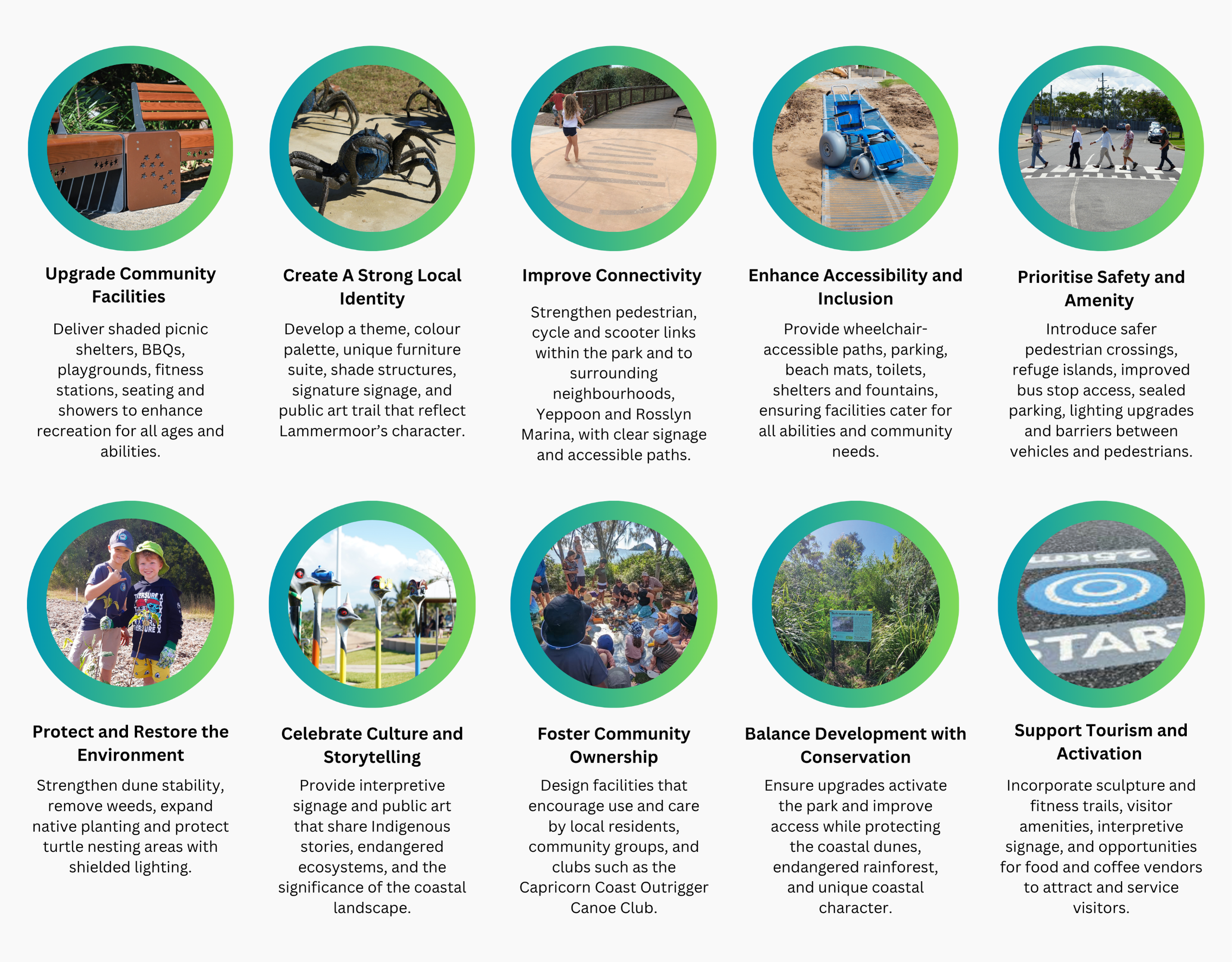
Lammermoor Beach (South) Master Plans Goals
Lammermoor Beach (South) Master Plan Goals
Lammermoor Beach (South) Master Plan: Site Area Concepts
Lammermoor Beach (South) Master Plan: Site Area Concepts
Livingstone Shire Council, together with Design+Architecture and Greenedge Design, has developed an exciting vision for the Lammermoor Beach (South) Master Plan.
The vision presented here builds on ideas, suggestions and feedback received during community engagement undertaken in October 2025, as well as earlier consultation in late 2023. It reflects both the community’s aspirations and the opportunities identified by Council to guide future growth and prosperity, in line with the goals of the Master Plan.
Click on the tabs below to view the draft concept plans for each site area.
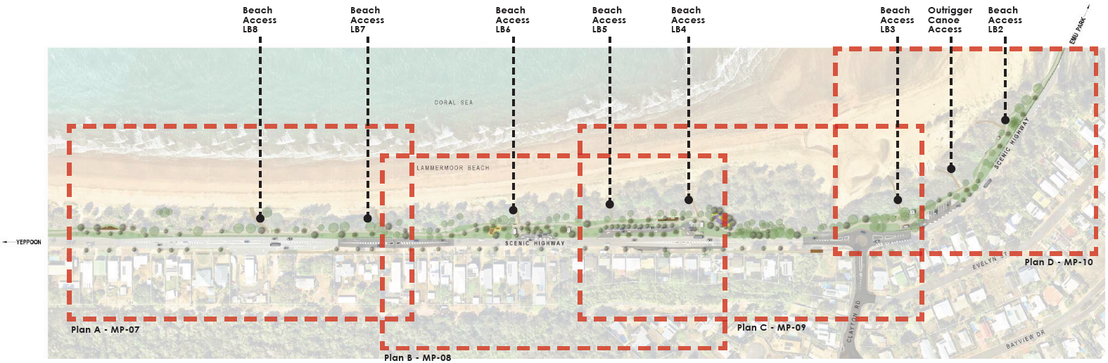
Lammermoor Beach (South) Master Plan: Overall Site Plan - Beach Accesses LB2 to LB8.
The Lammermoor Beach (South) Draft Master Plan is composed of four distinct map areas - A, B, C and D. Click on the image to open up a larger image on a new page.
Master Plan Area A: Beach Access LB7 and LB8
Site Area A is located near beach accesses LB7 and LB8 and opposite the Seabreeze Service Station.
It is a straight, narrow corridor typically used by pedestrians and cyclists, and a high-traffic area of the Scenic Highway with inbound traffic to the adjacent service station and boating workshop.
Key features and improvements in Area A of the draft Master Plan include:
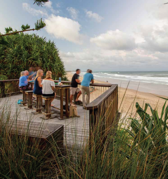
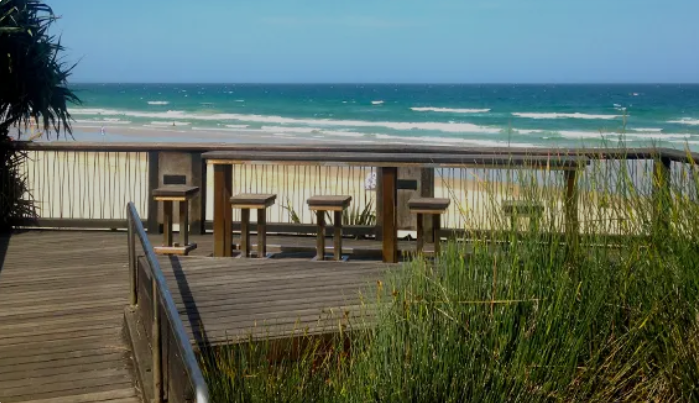
- all accessible raised viewing deck encroaching into the dune area and with a view to the Keppels
- road refuge crossings for safer access to adjacent Lammermoor businesses
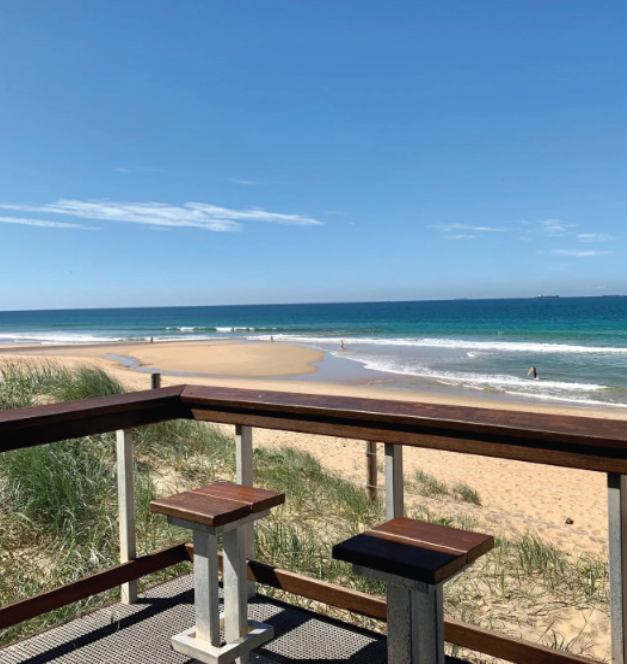
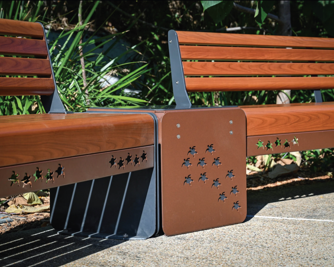
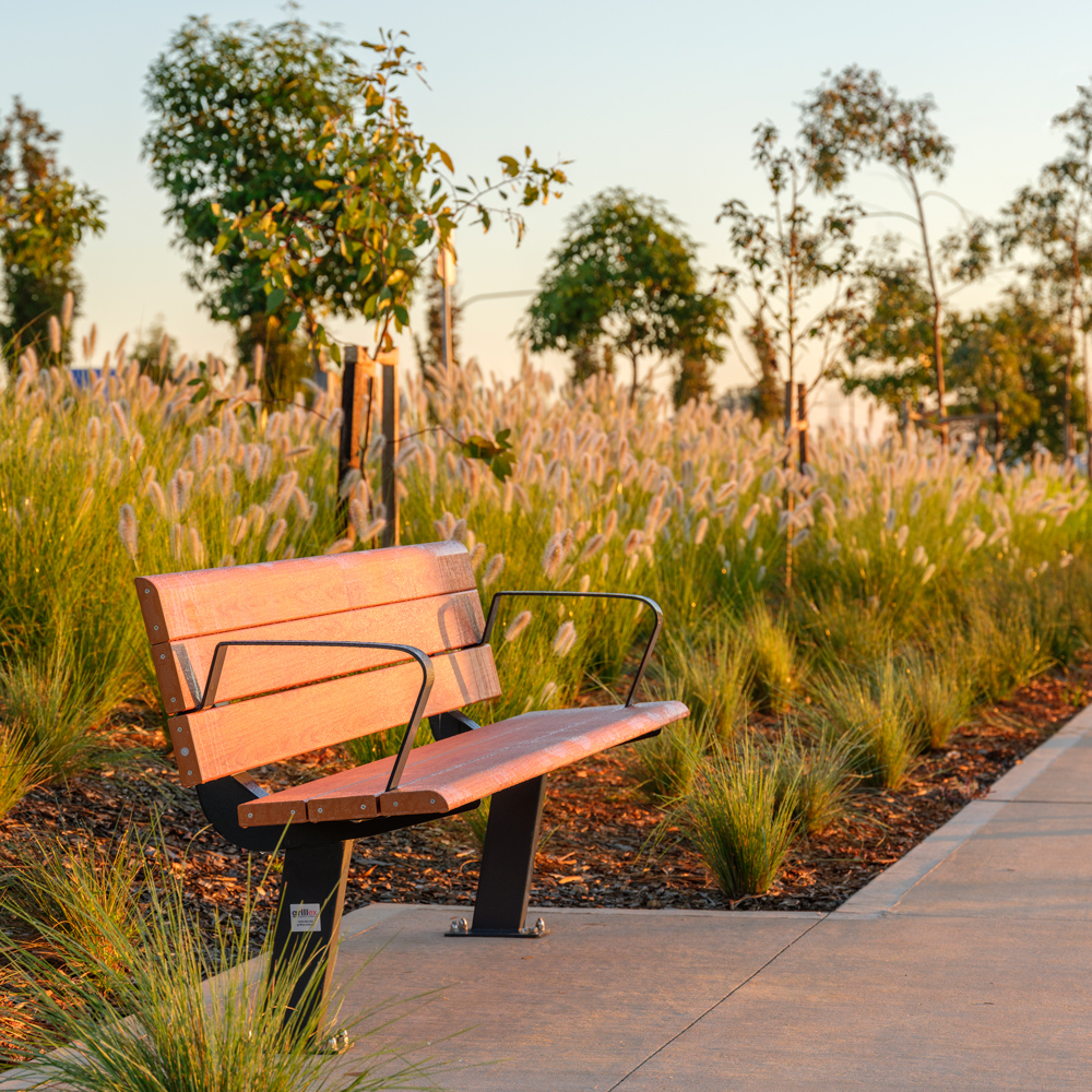
- high bar bench and bar stools for eating and resting
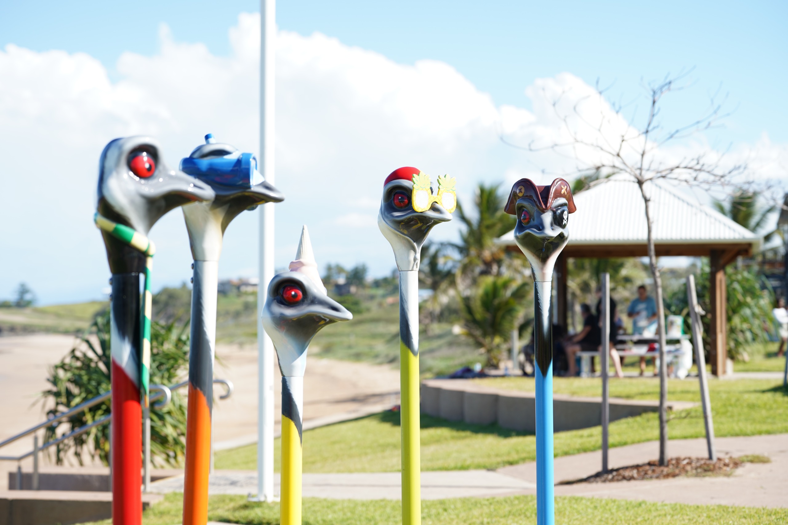
- identified locations for inclusion of new public artwork and sculptures
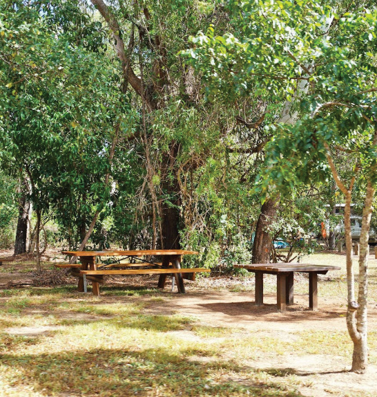
- additional picnic tables, seating and cycle stands.
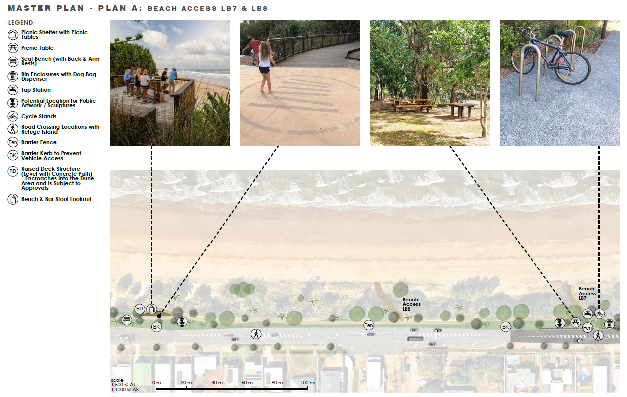
Image 1 of 4
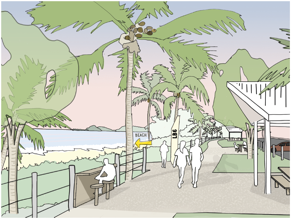
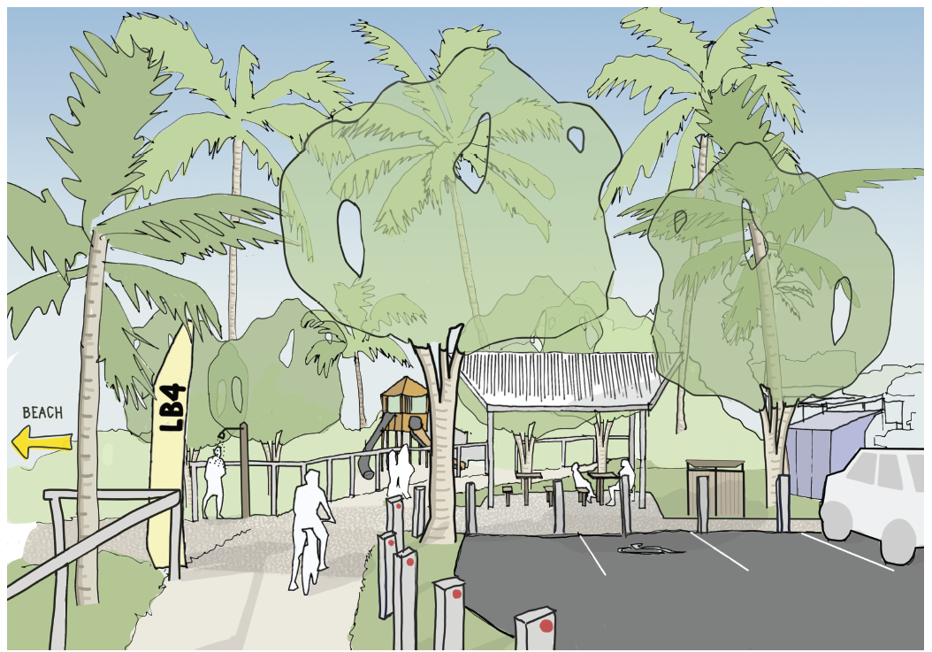
Master Plan Area B: Beach Access LB4 to LB6
Site Area B is located across beach accesses LB4, LB5 and LB6 and incorporates Detail Area Plan LB6.
Area B is a wider corridor of the Lammermoor Beach (South) scope area and currently offers informal beachside parking and a concrete pedestrian and cycle path.
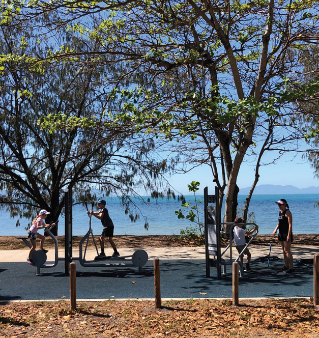
Key features and improvements proposed in Area B and Detail Area Plan LB6 of the draft Master Plan include:
- improved, formalised parking with sealed pavement
- fitness equipment stations
- identified locations for inclusion of new public artwork and sculptures
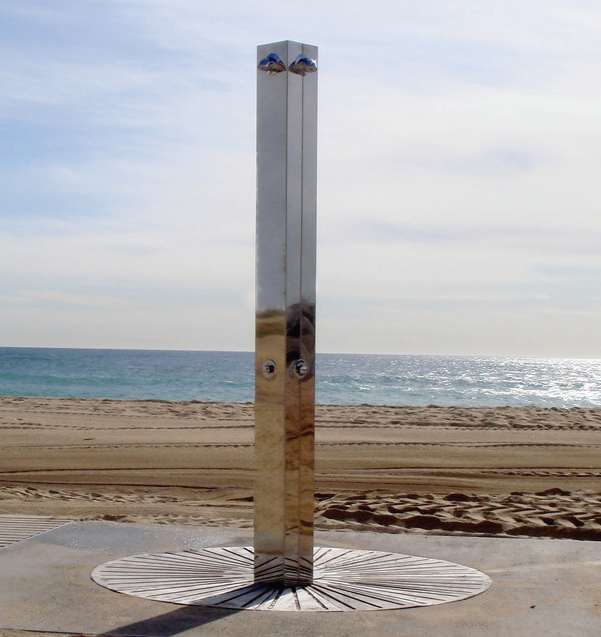
- beach showers and taps
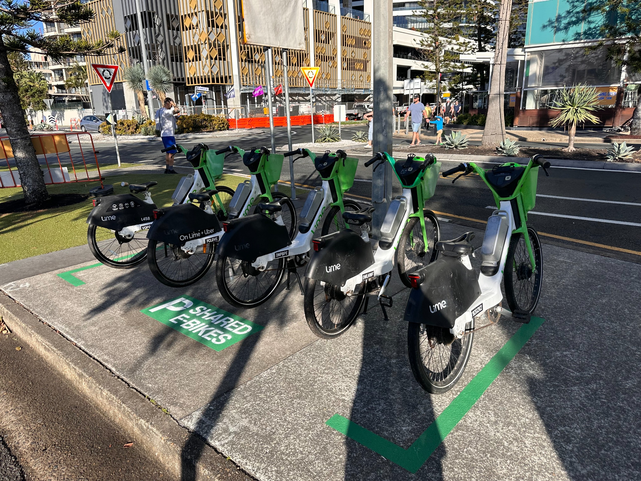
- additional cycle and scooter stands
- tables, benches, high bar bench and bar stools.
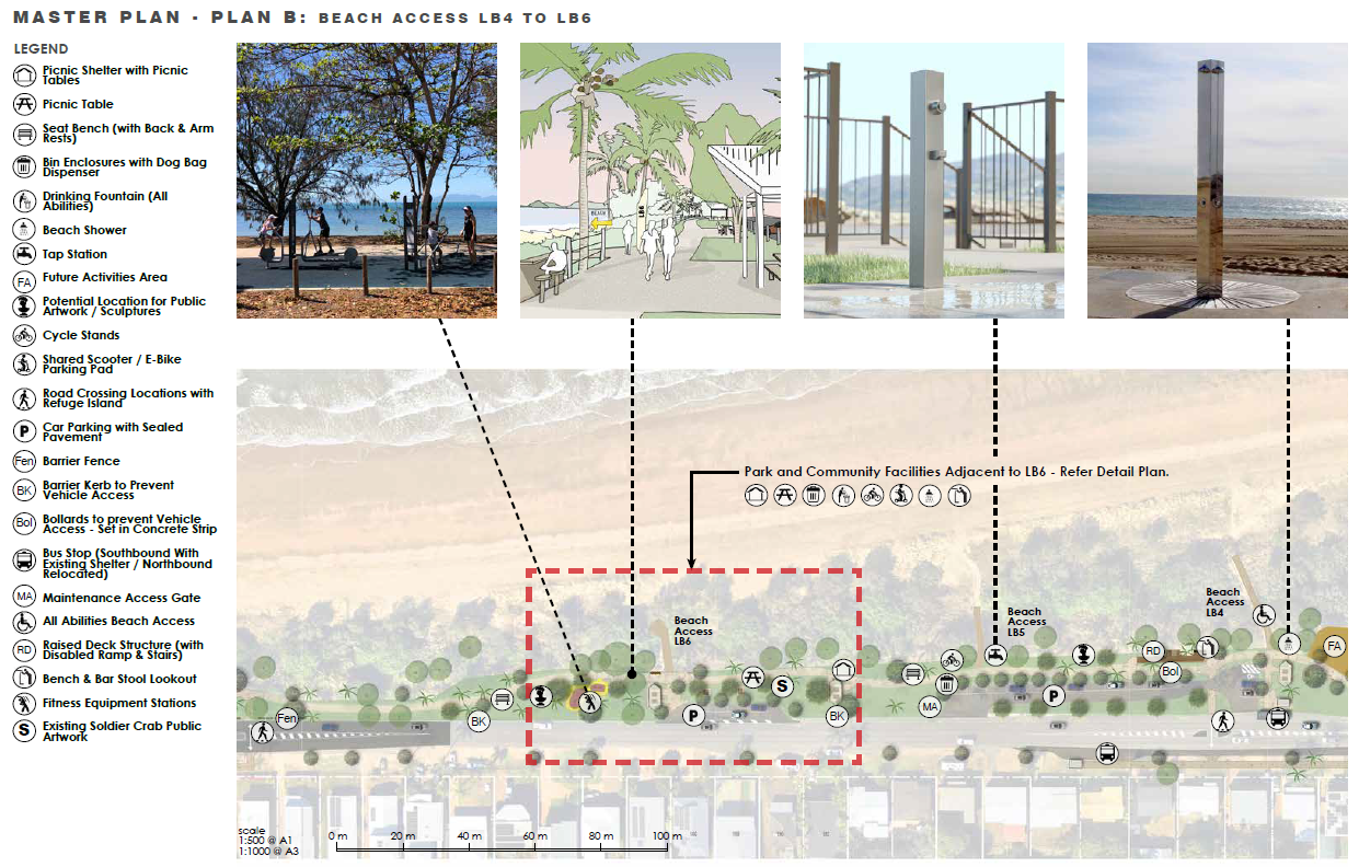
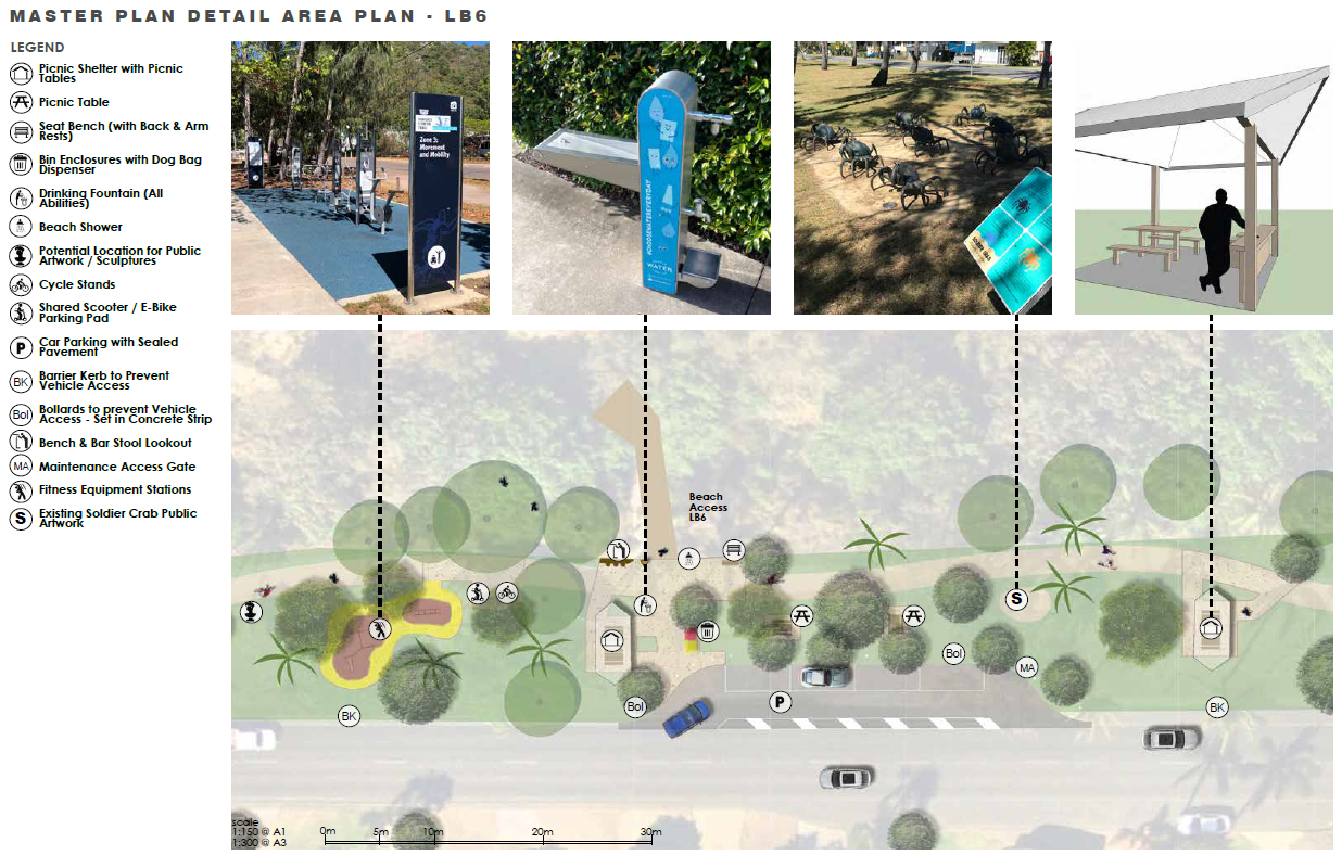
Image 1 of 4
Master Plan Area C: Beach Access LB3, LB4 and LB5
Site Area C is located across beach accesses LB3, LB4 and LB5, and incorporates Detail Area Plan LB4.
Area C is a wider corridor of the Lammermoor Beach (South) area and a high-traffic area along the Scenic Highway. It incorporates the Clayton Street roundabout and footpaths.
Key features and improvements proposed in Area C and Detail Area Plan LB4 of the Master Plan include:
- a second, all accessible raised viewing platform with a view to the Keppels
- improved, formalised parking with sealed pavement
- improved beach wheelchair access at LB4
- future activities area
- beach showers and taps
- interpretative signage throughout dense rainforest vegetation area
- relocated public bus shelter
- additional cycle and scooter stands
- tables, benches, high-bar bench, and bar stools.
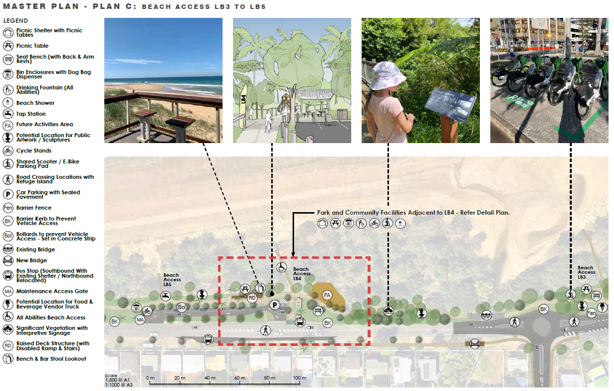
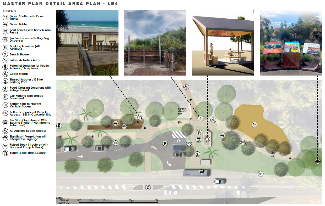
Image 1 of 5
Master Plan Area D: Beach Access LB2, LB3 and Outrigger Access
Site Area D is located across beach accesses LB2 and LB3 and incorporates Detail Area Plan LB3.
Area D of the Lammermoor Beach (South) scope area incorporates the existing public amenities block, the Capricorn Coast Outrigger Canoe Club access and a large informal parking area near the Clayton Street roundabout.
Key features and improvements proposed in Area D and Detail Area Plan LB3 of the Master Plan include:
- improved, formalised parking with sealed pavement
- improved beach wheelchair access at LB3
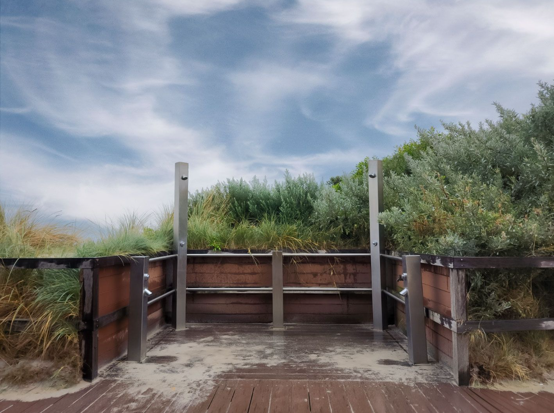
- beach showers and taps
- potential location for food and beverage vendor truck, including power and water connection pillar
- feature rock outcrop with vegetation and interpretative signage
- tables, benches, and cycle and scooter stands
- improvements to the CCOCC access area, including improved lighting and a tap for washdown.
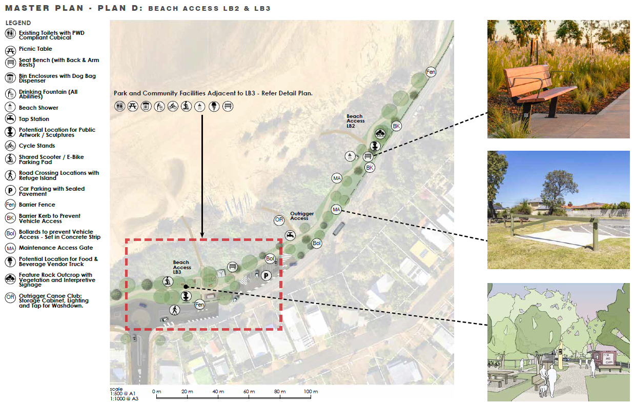
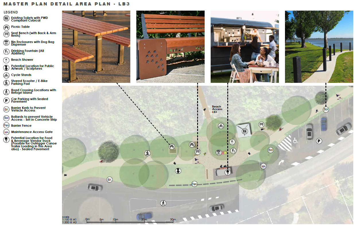
Image 1 of 4

Do you have a question about the Lammermoor Beach (South) Master Plan project? Ask us here...
To ask a question you must create an account or log in.
These are the people that are listening and responding to your questions.

LSC Infrastructure Services
{{question.description}}


