Connecting communities, coastlines and lifestyles.
Livingstone Shire Council is moving ahead with the staged delivery of the Yeppoon to Zilzie Shared Path, a key active transport corridor along the Capricorn Coast and a recognised route within Queensland’s Principal Cycle Network.
This long-term project aims to connect the coastal communities of Yeppoon, Taranganba, Lammermoor, Rosslyn Bay, Mulambin, Kinka Beach, Tanby Point, Emu Park, and Zilzie through a continuous, safe, and accessible shared pathway for both pedestrians and cyclists.
Backed by strong community support and growing demand for active lifestyle infrastructure, the project is being delivered in stages to improve local connectivity, create more recreation opportunities, and encourage sustainable tourism. Once complete, the shared path will provide easier access to key destinations and enhance the wellbeing of both residents and visitors.
You can view the overall masterplan here.
How will this shared path benefit the community?
- Better public health through more opportunities to walk and cycle
- Improved mental wellbeing and stronger social connections through outdoor recreation
- Increased tourism by linking key coastal destinations
- Reduced traffic congestion with more transport alternatives available
- Better beach access for locals and visitors
- More spaces for dog walking and family-friendly activities
- Stronger support for Council’s active transport and climate resilience goals
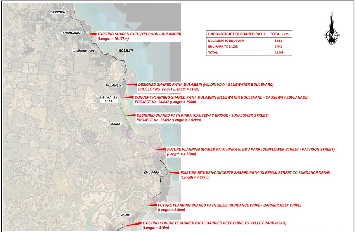
Pathway stages
Completed pathways
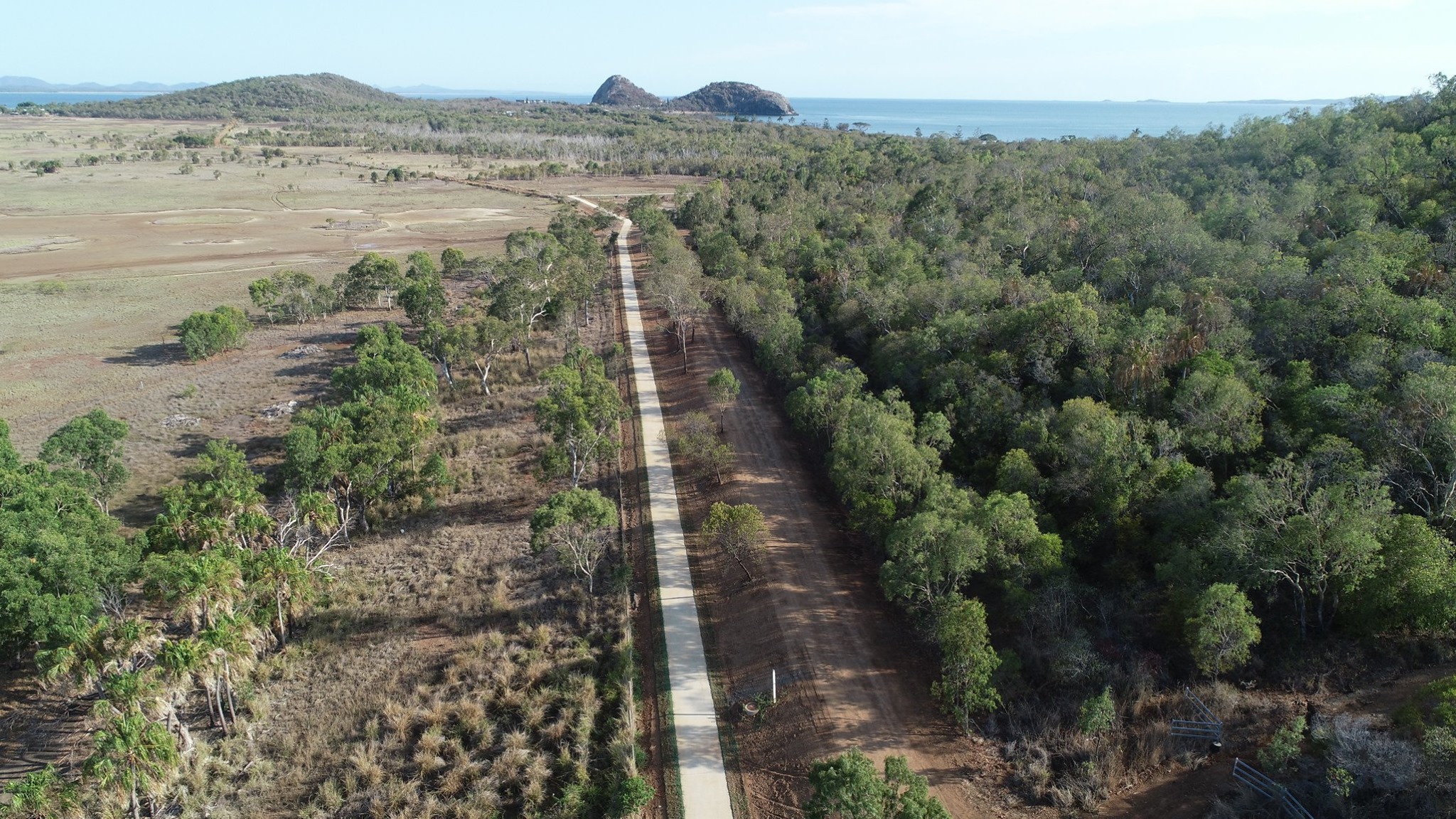
Yeppoon to Mulambin (10.17 km)
This 10.17 km shared path runs from Yeppoon to Wildin Way in Mulambin, connecting Yeppoon, Taranganba, Rosslyn Bay, and Mulambin. It follows the coastline and supports both recreational use and everyday walking and cycling. It serves as key section of the broader Princple Cycle Network.
Emu Park (4.57 km)
This 4.57 km shared path runs from Sleeman Street, Emu Park to Sundance Drive in Zilzie. This path plays an important role in supporting local connectivity as well as the longer coastal active transport corridor.
Designed pathways
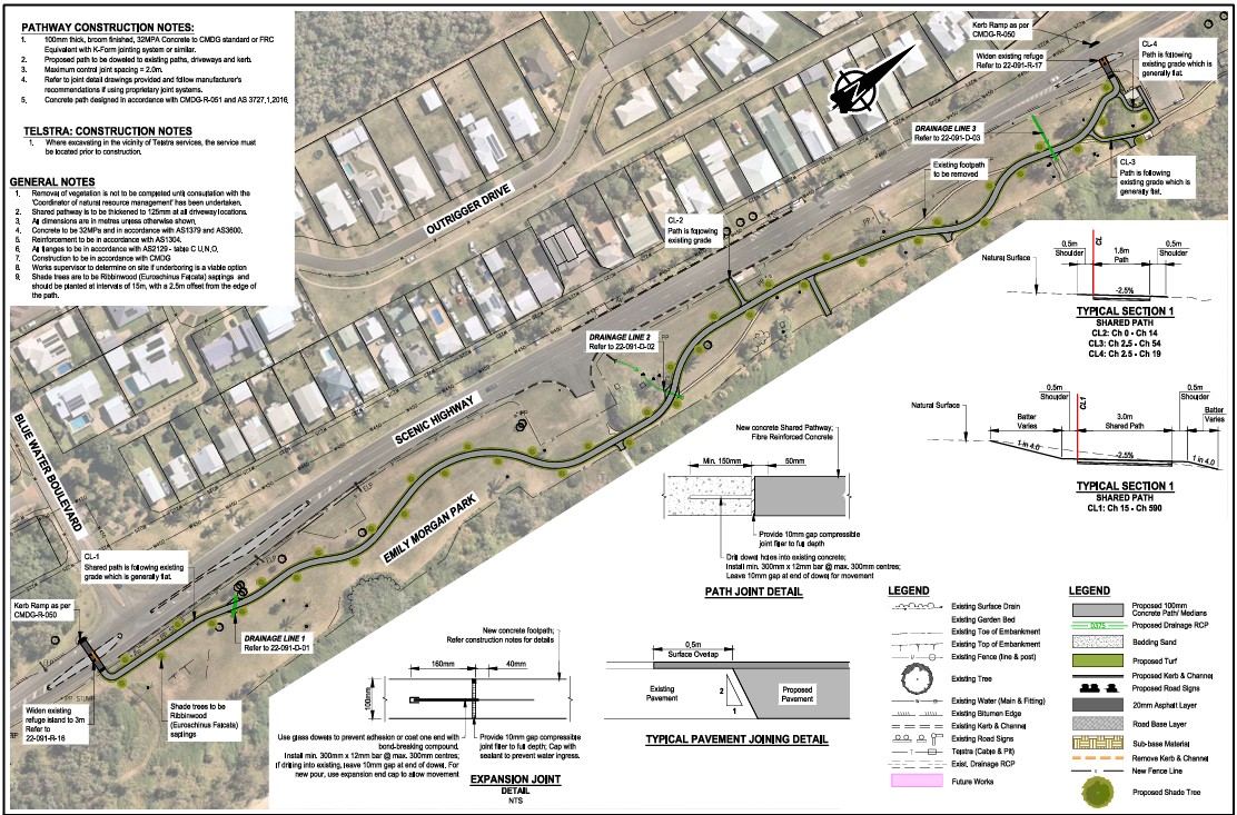
Mulambin (617 m)
The concept design for this section from Wildin Way to Bluewater Boulevard in Mulambin is done and is eligible for detailed design (subject to budget). Once delivered, it will connect Mulambin to the existing shared path network extending from Yeppoon, enhancing coastal access and continuity. View the plans here.
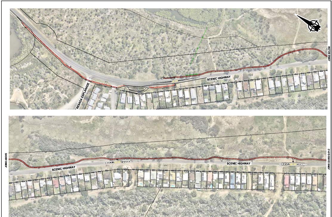
Kinka (2.52 km)
The initial design for this section from Causeway Bridge to Sunflower Street is completed and eligible for detailed design (subject to budget). View the plans here.
Pathways in planning
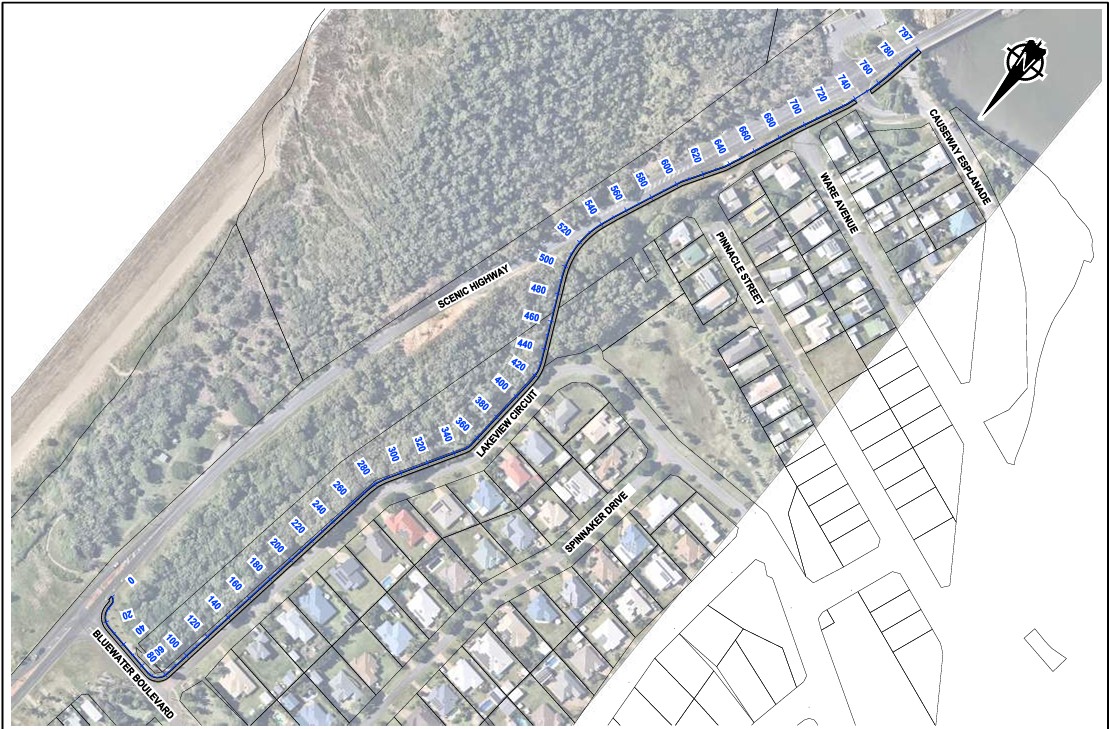
Mulambin (796 m)
This section will connect central Mulambin (Bluewater Boulevard) to the Causeway Lake bridge. Currently in the concept planning stage, the project is eligible to progress to detailed design, subject to future budget deliberations. View the plans here.
Kinka to Emu Park (4.72 km)
Connecting Kinka to Emu Park is a key long-term objective for Council. The proposed link from Sunflower Street to Pattison Street will complete the coastal shared path network from Yeppoon to Emu Park.
This section is currently in the early planning stage and has not yet progressed to detailed design, but it is eligible for funding and will be delivered accordingly. Additionally, this path is along a state controlled road and has a number of complexities, such as road crossings and bridges, that require further consideration.
Emu Park to Zilzie (3.5 km)
This section will connect Sundance Drive in Emu Park to the existing 815 m path at Valley Park Road in Zilzie, forming a key link in the principal cycle network.
At the Ordinary Council Meeting on 19 August 2025, a deputation was presented on behalf of the local community including families, youth, and seniors - advocating for a safe and connected pathway linking Keppel Cove Estate in Zilzie with surrounding estates and into Emu Park.
In response to this deputation, Council resolved to immediately install cyclist safety signage along Svendsen Road to address current safety concerns. Recognising the importance of this route, Council will be engaging with the Department of Transport and Main Roads to change the route’s status within the Principal Cycle Network Plan from priority D to B.
The timeline of the project now is:
- Designed 2026–27 financial year
- Construction 2027–28 financial year
This section will play a vital role in completing the coastal shared path network, enhancing connectivity, safety, and accessibility for the Zilzie and Emu Park communities.
Do you have a question about the Yeppoon to Zilzie Shared Path Masterplan? Ask us here.
To ask a question you must create an account or log in.
These are the people that are listening and responding to your questions.

LSC Engagement Team
{{question.description}}


